|
|
Weather Alert |
| Randolph County, WV | |||||||||
|
|
||||||||
|
Canceled 3/2/26 8:44 AM Winter Storm Warning issued March 2 at 12:49AM EST until March 3 at 10:00AM EST by NWS Charleston WV * WHAT... Heavy mixed precipitation expected. Total snow accumulations between 1 and 3 inches and ice accumulations up to three tenths of an inch. Locally higher amounts of ice accumulations could be possible. * WHERE... Northwest Pocahontas and Southeast Randolph Counties. * WHEN... From 7 AM this morning to 10 AM EST Tuesday. * IMPACTS... Power outages and tree damage are likely due to the ice. Travel could be nearly impossible this evening into Tuesday morning. The hazardous conditions could impact the morning and evening commutes as well as the Tuesday morning commute. * ADDITIONAL DETAILS... This event will start as all snow with a bulk of the snow accumulations falling this morning into the early afternoon. Freezing rain is then expected to start mixing in by the afternoon and will continue into the evening. This mix is expected to become mostly freezing rain tonight into Tuesday morning. This time period is where a bulk of the ice accretions will occur resulting in the impacts listed. 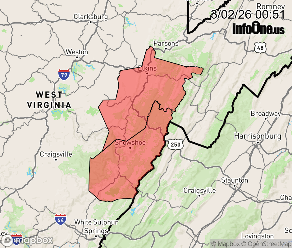 |
|||||||||
 Why aren't you using the InfoOne app? Why aren't you using the InfoOne app?
Stay abreast of information affecting your community! InfoOne tracks real-time information such as:
InfoOne currently supports over 100 communities in NC, VA and WV, and our coverage area is steadily growing. It's free! Install the InfoOne app today and see what you've been missing. |
|||||||||