|
|
Weather Alert |
| Grant County, WV | |||||||||
|
|
||||||||
|
Winter Weather Advisory issued January 14 at 4:12PM EST until January 15 at 10:00AM EST by NWS Baltimore MD/Washington DC ...RAIN CHANGING TO SNOW WITH A FLASH FREEZE TONIGHT INTO THURSDAY MORNING... .A strong cold front will cross the area later this evening. Precipitation may mix with snow near 4000 feet elevation as soon as this afternoon, but more impactful snow down to elevations near 2500 feet along with rapidly falling temperatures are expected beginning between 7 and 10 PM this evening. Expect on and off periods of heavier upslope snow showers/squalls late Thursday morning into THursday afternoon. * WHAT... Snow expected. Total snow accumulations up to 4 inches. Winds gusting as high as 45 mph. Wind chills falling into the single digits to below zero late tonight into Thursday morning. * WHERE... In Maryland, Western Garrett County. In West Virginia, Western Grant and Western Pendleton Counties. * WHEN... Until 10 AM EST Thursday. * IMPACTS... Plan on slippery road conditions. The hazardous conditions could impact the Thursday morning commute, especially along the I-68/US-40 corridor west of Frostburg, MD, US-48 west of Moorefield, WV, and US-33 west of Franklin, WV. Gusty winds could bring down tree branches. 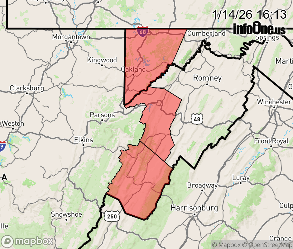 |
|||||||||
 Why aren't you using the InfoOne app? Why aren't you using the InfoOne app?
Stay abreast of information affecting your community! InfoOne tracks real-time information such as:
InfoOne currently supports over 100 communities in NC, VA and WV, and our coverage area is steadily growing. It's free! Install the InfoOne app today and see what you've been missing. |
Is this information important? Please share: Tweet | ||||||||