|
|
Weather Alert |
| Washington County, OH | |||||||||
|
|
||||||||
|
Canceled 6/26/25 4:30 PM Special Weather Statement issued June 26 at 4:03PM EDT by NWS Charleston WV At 403 PM EDT, Doppler radar was tracking strong thunderstorms along a line extending from near Nelsonville to near Albany. Movement was east at 45 mph. HAZARD...Wind gusts up to 40 mph and pea size hail. SOURCE...Radar indicated. IMPACT...Gusty winds could knock down tree limbs and blow around unsecured objects. Minor hail damage to vegetation is possible. Locations impacted include... Athens, Nelsonville, New Lexington, Glouster, Somerset, Albany, Shawnee, Coolville, Chesterhill, Lake Hope State Park, Perry State Forest, Thornport, Harbor Hills, Crooksville, Chauncey, Thornville, Junction City, New Straitsville, Corning, and Buchtel. 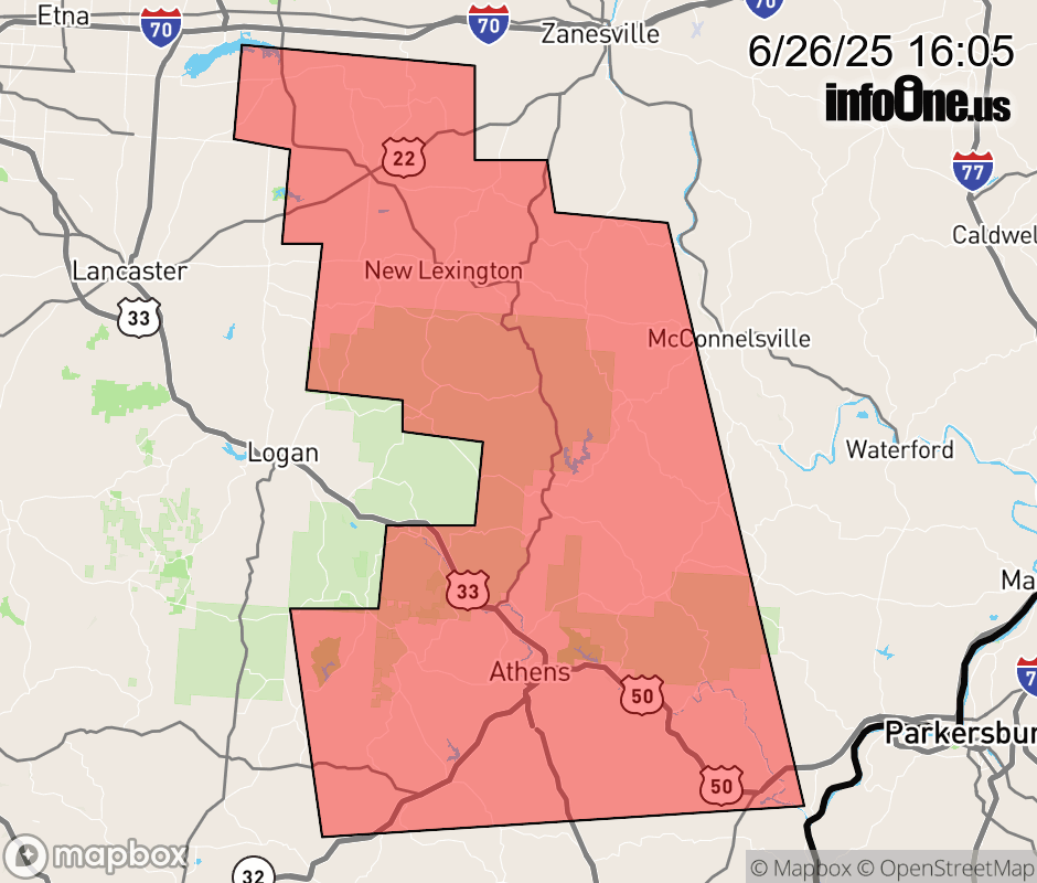 |
|||||||||
 Why aren't you using the InfoOne app? Why aren't you using the InfoOne app?
Stay abreast of information affecting your community! InfoOne tracks real-time information such as:
InfoOne currently supports over 100 communities in NC, VA and WV, and our coverage area is steadily growing. It's free! Install the InfoOne app today and see what you've been missing. |
|||||||||