|
|
Weather Alert |
| Boone County, WV | |||||||||
|
|
||||||||
|
Canceled 7/17/25 3:00 PM Special Weather Statement issued July 17 at 2:30PM EDT by NWS Charleston WV At 230 PM EDT, Doppler radar was tracking a strong thunderstorm over Alum Creek, or 8 miles south of Nitro, moving southeast at 30 mph. HAZARD...Wind gusts up to 40 mph and pea size hail. SOURCE...Radar indicated. IMPACT...Gusty winds could knock down tree limbs and blow around unsecured objects. Minor hail damage to vegetation is possible. Locations impacted include... Charleston, Nitro, Jefferson, South Charleston, St. Albans, Dunbar, Marmet, Belle, Alum Creek, Institute, Tornado, Coal Fork, Pinch, Cross Lanes, Seth, Sod, Ashford, and Racine. This includes the following highways... Interstate 79 between mile markers 1 and 3. Interstate 77 in West Virginia between mile markers 96 and 105. Interstate 64 in West Virginia between mile markers 46 and 57. West Virginia Turnpike between mile markers 89 and 95. Route 119 between mile markers 62 and 80. 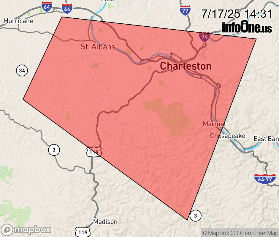 |
|||||||||
 Why aren't you using the InfoOne app? Why aren't you using the InfoOne app?
Stay abreast of information affecting your community! InfoOne tracks real-time information such as:
InfoOne currently supports over 100 communities in NC, VA and WV, and our coverage area is steadily growing. It's free! Install the InfoOne app today and see what you've been missing. |
|||||||||