|
|
Weather Alert |
| Wayne County, WV | |||||||||
|
|
||||||||
|
Canceled 2/19/26 5:02 PM Severe Thunderstorm Warning issued February 19 at 4:47PM EST until February 19 at 5:30PM EST by NWS Charleston WV SVRRLX The National Weather Service in Charleston West Virginia has issued a * Severe Thunderstorm Warning for... Southwestern Lincoln County in central West Virginia... Northwestern Logan County in southern West Virginia... Southeastern Wayne County in western West Virginia... West central Boone County in central West Virginia... * Until 530 PM EST. * At 447 PM EST, a severe thunderstorm was located near Harts, or 15 miles northwest of Logan, moving east at 25 mph. HAZARD...60 mph wind gusts and quarter size hail. SOURCE...Radar indicated. IMPACT...Hail damage to vehicles is expected. Expect wind damage to roofs, siding, and trees. * Locations impacted include... Madison, Chapmanville, Harts, Danville, Mitchell Heights, Turtle Creek, Blair, and Sharples. This includes Route 119 between mile markers 31 and 53. 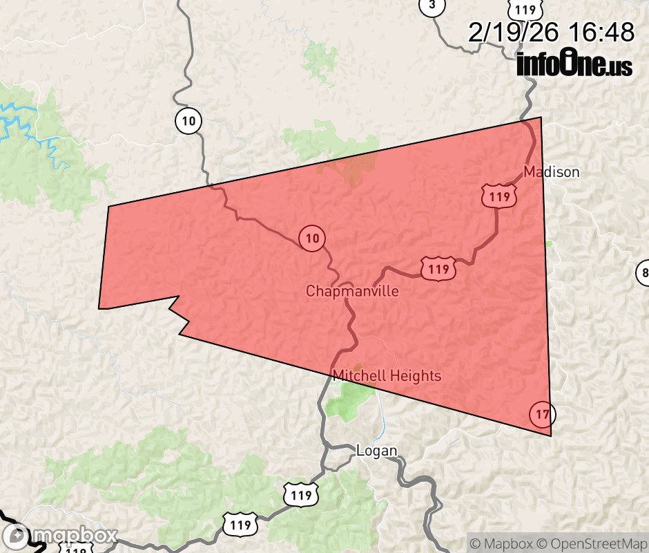 |
|||||||||
 Why aren't you using the InfoOne app? Why aren't you using the InfoOne app?
Stay abreast of information affecting your community! InfoOne tracks real-time information such as:
InfoOne currently supports over 100 communities in NC, VA and WV, and our coverage area is steadily growing. It's free! Install the InfoOne app today and see what you've been missing. |
|||||||||