|
|
Weather Alert |
| Scott County, VA | |||||||||
|
|
||||||||
|
Canceled 12/6/21 11:00 AM Special Weather Statement issued December 6 at 9:53AM EST by NWS Morristown TN At 953 AM EST, Doppler radar was tracking strong thunderstorms along a line extending from Littcarr to near Harrogate. Movement was east at 45 mph. HAZARD...Winds in excess of 40 mph. SOURCE...Radar indicated. IMPACT...Gusty winds could knock down tree limbs and blow around unsecured objects. Locations impacted include... Norton, Wise, Jonesville, Big Stone Gap, Pennington Gap, Clover Fork, Coeburn, Appalachia, Pound and Dungannon. 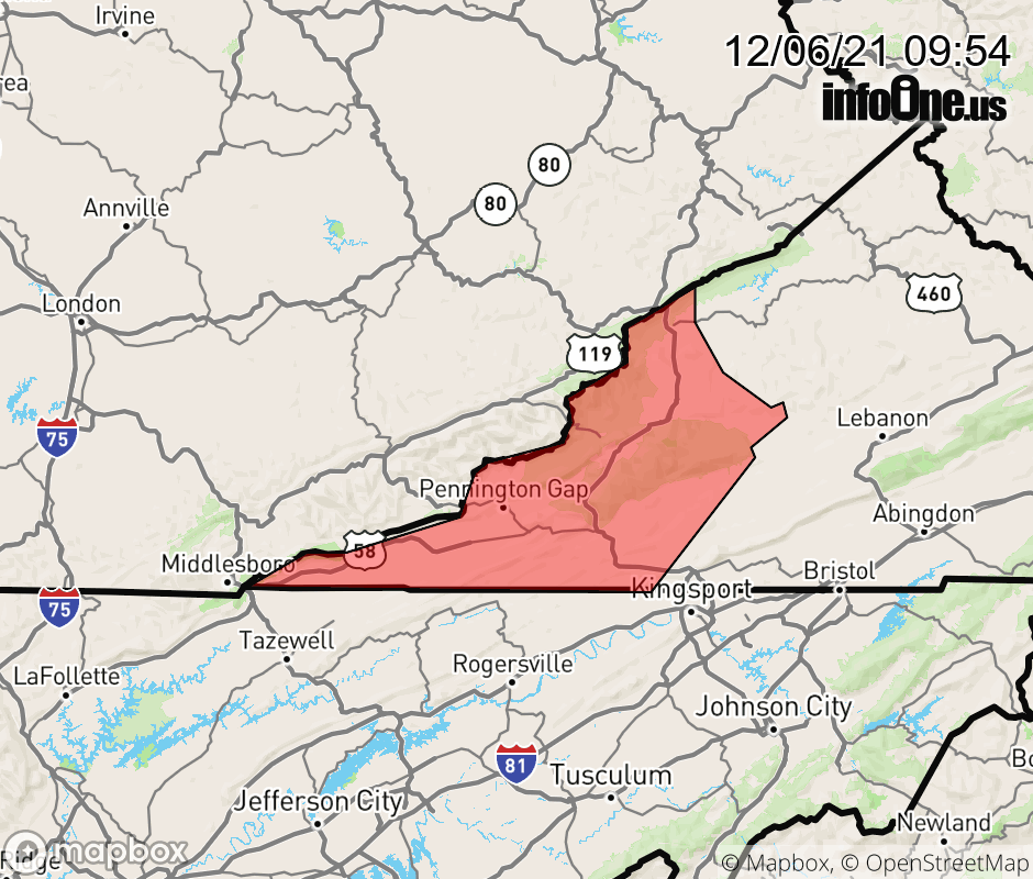 |
|||||||||
 Why aren't you using the InfoOne app? Why aren't you using the InfoOne app?
Stay abreast of information affecting your community! InfoOne tracks real-time information such as:
InfoOne currently supports over 100 communities in NC, VA and WV, and our coverage area is steadily growing. It's free! Install the InfoOne app today and see what you've been missing. |
|||||||||