|
|
Weather Alert |
| Grant County, WV | |||||||||
|
|
||||||||
|
Canceled 2/11/26 8:00 PM Special Weather Statement issued February 11 at 11:50AM EST by NWS Baltimore MD/Washington DC * WHAT... Patchy freezing drizzle changing to snow showers. Winds gusting as high as 45 mph. * WHERE... Near and west of the Allegheny Front for snow, near and east of the Allegheny Front for wind. * WHEN... This afternoon through Thursday. * IMPACTS... Plan on slippery road conditions. Gusty winds could bring down tree branches. * ADDITIONAL DETAILS... Patchy freezing drizzle may redevelop by mid afternoon before transitioning quickly to snow showers. These snow showers may be moderate at times this evening, perhaps spilling into the foothills. Localized snowfall accumulations of 1 to 3 inches are possible, mainly along west- facing slopes above 2500 feet through Thursday. The strongest wind gusts to near 45 mph are expected through this evening near and east of the Allegheny Front. 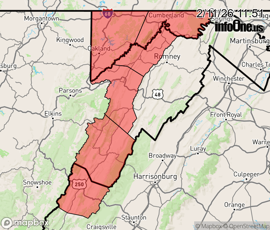 |
|||||||||
 Why aren't you using the InfoOne app? Why aren't you using the InfoOne app?
Stay abreast of information affecting your community! InfoOne tracks real-time information such as:
InfoOne currently supports over 100 communities in NC, VA and WV, and our coverage area is steadily growing. It's free! Install the InfoOne app today and see what you've been missing. |
|||||||||