|
|
Weather Alert |
| McDowell County, WV | |||||||||
|
|
||||||||
|
Canceled 6/18/26 10:15 AM Special Weather Statement issued June 18 at 9:27AM EDT by NWS Charleston WV At 927 AM EDT, Doppler radar was tracking strong thunderstorms along a line extending from near Boissevain to Shelby Gap. Movement was southeast at 25 mph. HAZARD...Wind gusts up to 40 mph. SOURCE...Radar indicated. IMPACT...Gusty winds could knock down tree limbs and blow around unsecured objects. Locations impacted include... Clintwood, Grundy, Haysi, Breaks Interstate, Davenport, John Flannagan Lake, Gary, War, Trammel, Clinchco, Bradshaw, Anawalt, Jolo, Oakwood, Stacy, Elbert, Nora, Vansant, McClure, and Cucumber. 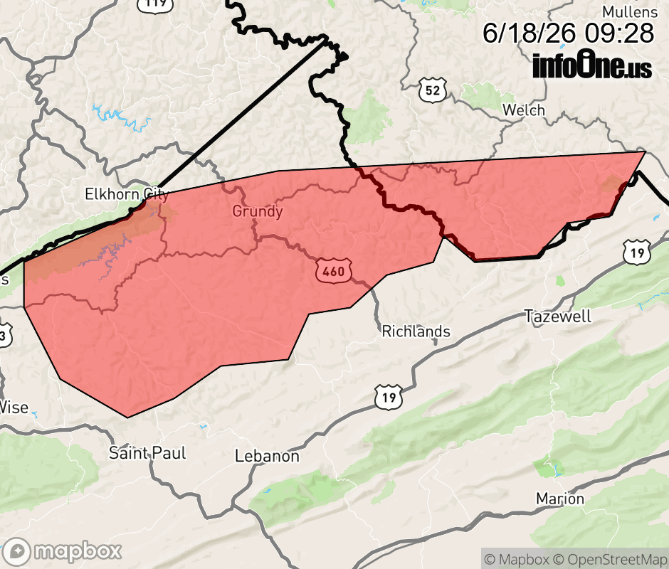 |
|||||||||
 Why aren't you using the InfoOne app? Why aren't you using the InfoOne app?
Stay abreast of information affecting your community! InfoOne tracks real-time information such as:
InfoOne currently supports over 100 communities in NC, VA and WV, and our coverage area is steadily growing. It's free! Install the InfoOne app today and see what you've been missing. |
|||||||||