|
|
Weather Alert |
| Taylor County, WV | |||||||||
|
|
||||||||
|
Flash Flood Warning issued June 28 at 1:38AM EDT until June 28 at 5:15AM EDT by NWS Charleston WV FFWRLX The National Weather Service in Charleston has extended the * Flash Flood Warning for... Barbour County in northeastern West Virginia... North Central Randolph County in northeastern West Virginia... East Central Doddridge County in northern West Virginia... Southern Harrison County in northern West Virginia... Southwestern Taylor County in northern West Virginia... * Until 515 AM EDT. * At 138 AM EDT, gauge reports indicated heavy rain falling. Radar is severely underestimating precipitation. Between 1.5 and 2.5 inches of rain have fallen. Additional rainfall amounts of 0.5 to 1 inch are possible in the warned area. Flash flooding is already occurring. HAZARD...Flash flooding caused by heavy rain. SOURCE...Gauges reported. IMPACT...Flash flooding of small creeks and streams, urban areas, highways, streets and underpasses as well as other poor drainage and low-lying areas. * Some locations that will experience flash flooding include... Clarksburg, Philippi, Bridgeport, Stonewood, Nutter Fort, Salem, Anmoore, West Milford, Lost Creek, Montrose, Galloway, Moatsville, Wolf Summit, Nestorville and New Milton. This includes the following highways... Interstate 79 between mile markers 110 and 118. Route 50 in West Virginia between mile markers 58 and 75. 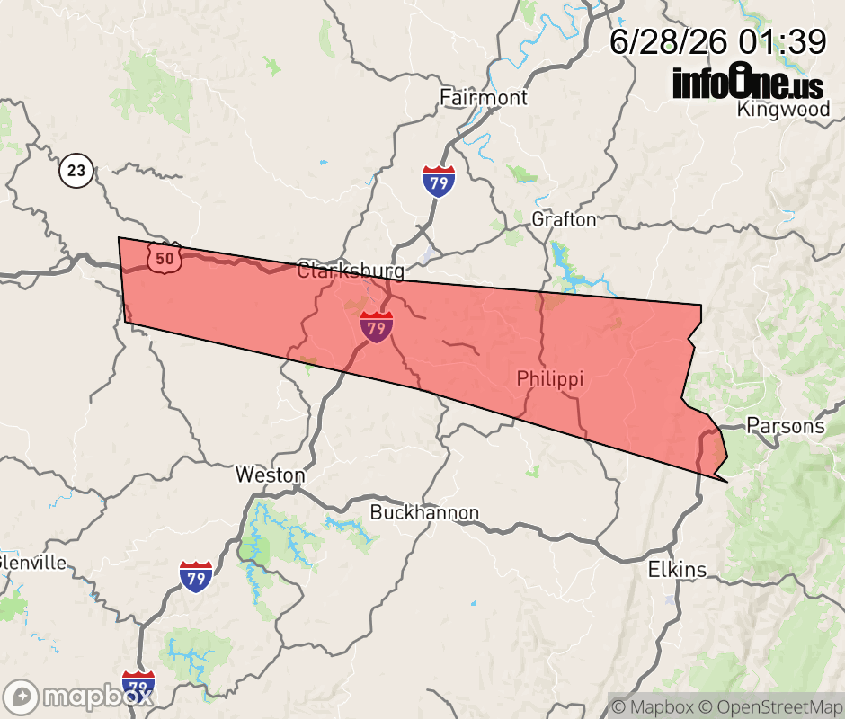 |
|||||||||
 Why aren't you using the InfoOne app? Why aren't you using the InfoOne app?
Stay abreast of information affecting your community! InfoOne tracks real-time information such as:
InfoOne currently supports over 100 communities in NC, VA and WV, and our coverage area is steadily growing. It's free! Install the InfoOne app today and see what you've been missing. |
Is this information important? Please share: Tweet | ||||||||