|
|
Weather Alert |
| Amherst County, VA | |||||||||
|
|
||||||||
|
Canceled 2/22/26 2:07 PM Winter Storm Warning issued February 22 at 8:38AM EST until February 23 at 7:00AM EST by NWS Baltimore MD/Washington DC * WHAT... Heavy snow expected. Total snow accumulations between 4 and 8 inches with localized amounts up to 12 inches on the highest peaks of Shenandoah National Park. The strongest winds are expected tonight through Monday with northwest winds gusting around 35 to 45 mph. * WHERE... Central Virginia Blue Ridge and Northern Virginia Blue Ridge. * WHEN... Until 7 AM EST Monday. * IMPACTS... Roads, and especially bridges and overpasses, will likely become slick and hazardous. Visibilities may drop below 1/4 mile due to falling and blowing snow. Travel could be very difficult. The hazardous conditions could impact the Monday morning commute. Gusty winds could bring down tree branches. * ADDITIONAL DETAILS... Visibilities may drop below 1/4 mile due to falling and blowing snow. The strong winds and weight of snow on tree limbs may down power lines and could cause sporadic power outages. Travel could be very difficult. 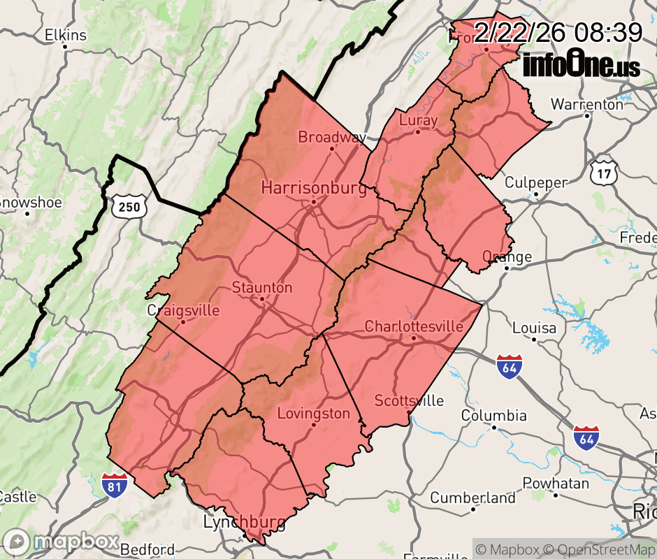 |
|||||||||
 Why aren't you using the InfoOne app? Why aren't you using the InfoOne app?
Stay abreast of information affecting your community! InfoOne tracks real-time information such as:
InfoOne currently supports over 100 communities in NC, VA and WV, and our coverage area is steadily growing. It's free! Install the InfoOne app today and see what you've been missing. |
|||||||||