|
|
Weather Alert |
| Pendleton County, WV | |||||||||
|
|
||||||||
|
Canceled 6/11/26 6:55 PM Severe Thunderstorm Warning issued June 11 at 6:36PM EDT until June 11 at 7:15PM EDT by NWS Baltimore MD/Washington DC SVRLWX The National Weather Service in Sterling Virginia has issued a * Severe Thunderstorm Warning for... Highland County in western Virginia... Southern Pendleton County in eastern West Virginia... * Until 715 PM EDT. * At 636 PM EDT, a severe thunderstorm was located near Green Bank, moving east at 30 mph. HAZARD...60 mph wind gusts. SOURCE...Radar indicated. IMPACT...Damaging winds will cause some trees and large branches to fall. This could injure those outdoors, as well as damage homes and vehicles. Roadways may become blocked by downed trees. Localized power outages are possible. Unsecured light objects may become projectiles. * Locations impacted include... Franklin, Monterey, Brandywine, Hightown, Doe Hill, Head Waters, Cherry Grove, New Hampden, Liberty, Harper, Circleville, Palo Alto, Mcdowell, Possum Trot, Blue Grass, Vanderpool, Moyers, Sirons Mill, and Sugar Grove. 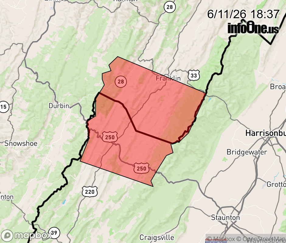 |
|||||||||
 Why aren't you using the InfoOne app? Why aren't you using the InfoOne app?
Stay abreast of information affecting your community! InfoOne tracks real-time information such as:
InfoOne currently supports over 100 communities in NC, VA and WV, and our coverage area is steadily growing. It's free! Install the InfoOne app today and see what you've been missing. |
|||||||||