|
|
Weather Alert |
| Belmont County, OH | |||||||||
|
|
||||||||
|
Canceled 3/22/26 6:43 PM Severe Thunderstorm Warning issued March 22 at 6:31PM EDT until March 22 at 7:00PM EDT by NWS Pittsburgh PA At 631 PM EDT, a severe thunderstorm was located over Cambridge, moving east at 40 mph. HAZARD...Half dollar size hail. SOURCE...Radar indicated. IMPACT...Damage to vehicles is expected. Locations impacted include... Cambridge, Byesville, Quaker City, Senecaville, Lore City, Old Washington, Salesville, Batesville and Salt Fork State Park. 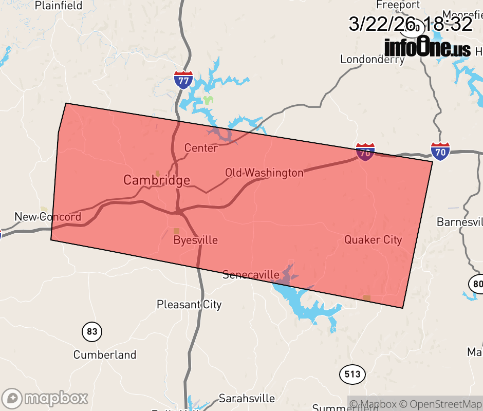 |
|||||||||
 Why aren't you using the InfoOne app? Why aren't you using the InfoOne app?
Stay abreast of information affecting your community! InfoOne tracks real-time information such as:
InfoOne currently supports over 100 communities in NC, VA and WV, and our coverage area is steadily growing. It's free! Install the InfoOne app today and see what you've been missing. |
|||||||||