|
|
Weather Alert |
| Pendleton County, WV | |||||||||
|
|
||||||||
|
Canceled 12/10/25 9:54 PM Blizzard Warning issued December 10 at 12:06PM EST until December 11 at 10:00AM EST by NWS Baltimore MD/Washington DC ...PERIOD OF POTENT MOUNTAIN SNOW WITH BLIZZARD CONDITIONS THROUGH LATE THURSDAY MORNING... .A period of snow, strong winds, and low visibility is expected especially for the western-facing slopes above 2500 feet along and west of the Allegheny Front. This evening and Thursday morning's commutes will be impacted. * WHAT... Blizzard conditions expected. Total snow accumulations between 4 and 7 inches, with locally 8 to 12 inches possible on the western-facing slopes above 2500 feet along and west of the Allegheny Front. Winds gusting as high as 50 mph. Visibility one-quarter mile or less. * WHERE... In Maryland, Western Garrett County. In West Virginia, Western Grant and Western Pendleton Counties. * WHEN... Until 10 AM EST Thursday. * IMPACTS... Whiteout conditions are expected and will make travel treacherous and potentially life-threatening. Plan on slippery road conditions. Widespread blowing snow could significantly reduce visibility. The hazardous conditions will impact this evening's and Thursday morning's commutes. Gusty winds could bring down tree branches. * ADDITIONAL DETAILS... A lull in the snow is possible through mid afternoon, then a burst of snow and squalls is expected late afternoon through early evening. Steady snow will continue through tonight before gradually tapering off Thursday morning. 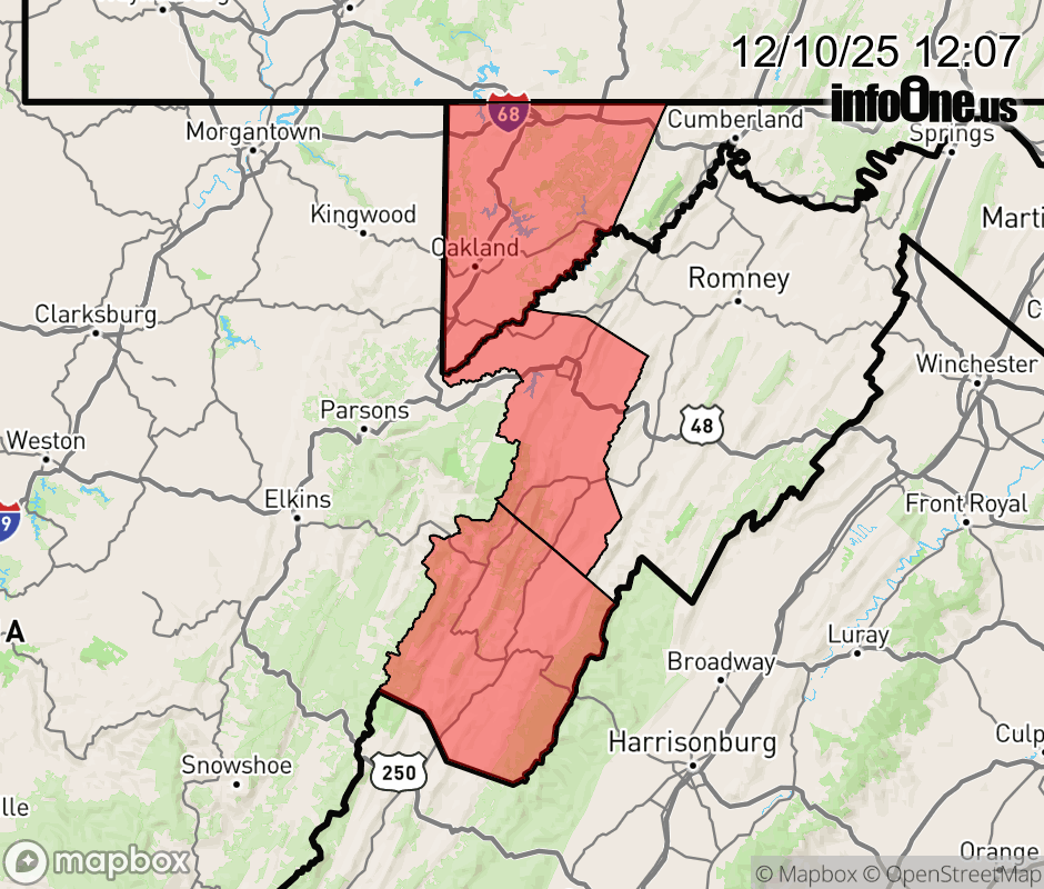 |
|||||||||
 Why aren't you using the InfoOne app? Why aren't you using the InfoOne app?
Stay abreast of information affecting your community! InfoOne tracks real-time information such as:
InfoOne currently supports over 100 communities in NC, VA and WV, and our coverage area is steadily growing. It's free! Install the InfoOne app today and see what you've been missing. |
|||||||||